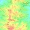
Arang topographic map
Click on the map to display elevation.
Arang
Arang, a prosperous ancient town, known for its many Jain and Hindu temples, is located on the west bank of the Mahanadi River, a Nagar Palika in Raipur District in Chhattisgarh, at 21°12′N 81°58′E / 21.2°N 81.97°E / 21.2; 81.97. It has an average elevation of 267 metres (876 ft). It is 36 kilometres (22 mi) from Raipur on National Highway 53 (N.H.53), a four lane expressway to Durg passing through Arang. It is 15 kilometres (9.3 mi) from Mahasamund city. There is also a four lane road from Arang to Tumgaon. The nearest airport is the Raipur Airport situated near Mana Camp, which is 23.8 kilometres (14.8 mi) away from Arang. Arang Is located beside National Highway 53 that connects Kolkata to Mumbai.
About this map

Name: Arang topographic map, elevation, terrain.
Location: Arang, Arang Tahsil, Raipur, Chhattisgarh, 493441, India (21.15863 81.92599 21.23863 82.00599)
Average elevation: 899 ft
Minimum elevation: 860 ft
Maximum elevation: 948 ft
Other topographic maps
Click on a map to view its topography, its elevation and its terrain.