Geolocate

Bezirk Reutte topographic map

Interactive map

Click on the map to display elevation.

About this map

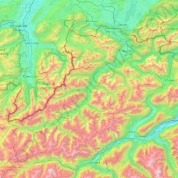
Name: Bezirk Reutte topographic map, elevation, terrain.

Location: Bezirk Reutte, Tyrol, Austria (47.15274 10.17421 47.58713 10.99118)

Average elevation: 4,767 ft

Minimum elevation: 2,113 ft

Maximum elevation: 10,272 ft

Other topographic maps

Click on a map to view its topography, its elevation and its terrain.

Gemeinde Breitenwang

Austria > Tyrol > Bezirk Reutte

Gemeinde Breitenwang, Bezirk Reutte, Tyrol, Austria

Average elevation: 4,111 ft

Gemeinde Elbigenalp

Austria > Tyrol > Bezirk Reutte

Gemeinde Elbigenalp, Bezirk Reutte, Tyrol, 6652, Austria

Average elevation: 5,469 ft