Geolocate

Thalli topographic map

Click on the map to display elevation.

About this map

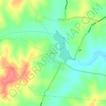
Name: Thalli topographic map, elevation, terrain.

Location: Thalli, Denkanikottai, Krishnagiri, Tamil Nadu, 635118, India (12.56677 77.63418 12.60677 77.67418)

Average elevation: 3,005 ft

Minimum elevation: 2,907 ft

Maximum elevation: 3,156 ft

Gear up for your next adventure:

🧺Microfiber Travel Towels - Compact and fast-drying towels for trail use
🌲Outdoor Survival Books - Best books on survival skills
🪄Magnetic Compass - Accurate compass for navigation
🎒Trail Energy Bars - High‑calorie bars for hiking energy
🛰️Satellite Messengers - Emergency SOS and two-way messaging for off-grid adventures

As an Amazon Associate, this site earns from qualifying purchases at no extra cost to you.