
Thank you for supporting this site ❤️
Make a donation
Make a donation
Gear up for your next adventure:
As an Amazon Associate, this site earns from qualifying purchases at no extra cost to you.
Jalamehellisi topographic map
Click on the map to display elevation.
Thank you for supporting this site ❤️
Make a donation
Make a donation
Gear up for your next adventure:
As an Amazon Associate, this site earns from qualifying purchases at no extra cost to you.
About this map
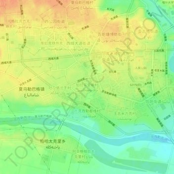
Name: Jalamehellisi topographic map, elevation, terrain.
Location: Jalamehellisi, Kashgar City, Kachgar, Xinjiang, 844000, China (39.43893 75.95422 39.47893 75.99422)
Average elevation: 4,239 ft
Minimum elevation: 4,170 ft
Maximum elevation: 4,298 ft
Thank you for supporting this site ❤️
Make a donation
Make a donation
Gear up for your next adventure:
As an Amazon Associate, this site earns from qualifying purchases at no extra cost to you.