
Thank you for supporting this site ❤️
Make a donation
Make a donation
Gear up for your next adventure:
As an Amazon Associate, this site earns from qualifying purchases at no extra cost to you.
Tevfikiye topographic map
Click on the map to display elevation.
Thank you for supporting this site ❤️
Make a donation
Make a donation
Gear up for your next adventure:
As an Amazon Associate, this site earns from qualifying purchases at no extra cost to you.
About this map
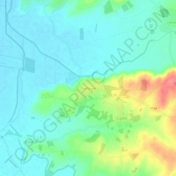
Name: Tevfikiye topographic map, elevation, terrain.
Location: Tevfikiye, Çanakkale Merkez, Canakkale, Marmara Region, Turkey (39.93884 26.23118 39.97884 26.27118)
Average elevation: 92 ft
Minimum elevation: 26 ft
Maximum elevation: 272 ft
Thank you for supporting this site ❤️
Make a donation
Make a donation
Gear up for your next adventure:
As an Amazon Associate, this site earns from qualifying purchases at no extra cost to you.
Other topographic maps
Click on a map to view its topography, its elevation and its terrain.