
Thank you for supporting this site ❤️
Make a donation
Make a donation
Gear up for your next adventure:
As an Amazon Associate, this site earns from qualifying purchases at no extra cost to you.
Torchiati topographic map
Click on the map to display elevation.
Thank you for supporting this site ❤️
Make a donation
Make a donation
Gear up for your next adventure:
As an Amazon Associate, this site earns from qualifying purchases at no extra cost to you.
About this map
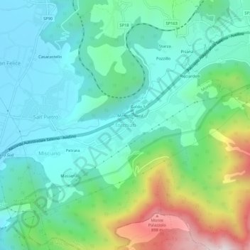
Name: Torchiati topographic map, elevation, terrain.
Location: Torchiati, Montoro, Avellino, Campania, 83025, Italia (40.79918 14.78165 40.83918 14.82165)
Average elevation: 1,283 ft
Minimum elevation: 600 ft
Maximum elevation: 3,235 ft
Thank you for supporting this site ❤️
Make a donation
Make a donation
Gear up for your next adventure:
As an Amazon Associate, this site earns from qualifying purchases at no extra cost to you.