Geolocate

Kulsari topographic map

Click on the map to display elevation.

About this map

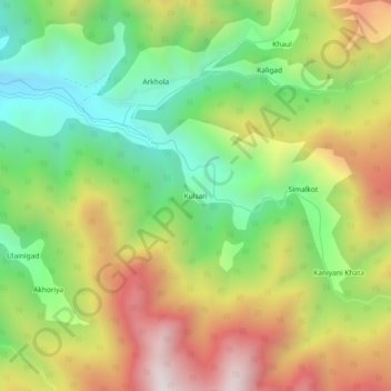
Name: Kulsari topographic map, elevation, terrain.

Location: Kulsari, Chaukhutiya, Almora, Uttarakhand, India (29.84577 79.44377 29.88577 79.48377)

Average elevation: 5,525 ft

Minimum elevation: 3,927 ft

Maximum elevation: 7,566 ft

Gear up for your next adventure:

🌲Outdoor Survival Books - Best books on survival skills
🦺Reflective Outdoor Gear - Safety gear for low‑light conditions
🔥Fast-Boil Camping Stoves - Efficient cooking systems for quick trail meals
🔦Compact Flashlight - Reliable flashlight for emergencies
📚USA Hiking Guide Books - Top trail guides and map books

As an Amazon Associate, this site earns from qualifying purchases at no extra cost to you.