
Thank you for supporting this site ❤️
Make a donation
Make a donation
Gear up for your next adventure:
As an Amazon Associate, this site earns from qualifying purchases at no extra cost to you.
Mawlamyine topographic map
Click on the map to display elevation.
Thank you for supporting this site ❤️
Make a donation
Make a donation
Gear up for your next adventure:
As an Amazon Associate, this site earns from qualifying purchases at no extra cost to you.
About this map
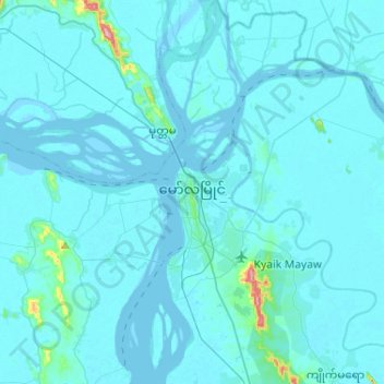
Name: Mawlamyine topographic map, elevation, terrain.
Location: Mawlamyine, Mawlamyine District, Mon State, Myanmar (16.36296 97.59003 16.61072 97.70554)
Average elevation: 36 ft
Minimum elevation: -10 ft
Maximum elevation: 863 ft
Thank you for supporting this site ❤️
Make a donation
Make a donation
Gear up for your next adventure:
As an Amazon Associate, this site earns from qualifying purchases at no extra cost to you.