Geolocate

Bayo topographic map

Click on the map to display elevation.

About this map

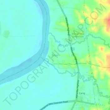
Name: Bayo topographic map, elevation, terrain.

Location: Bayo, Iguig, Cagayan, Cagayan Valley, Philippines (17.66859 121.72491 17.70859 121.76491)

Average elevation: 75 ft

Minimum elevation: 33 ft

Maximum elevation: 213 ft

Gear up for your next adventure:

👓Polarized Sunglasses - Outdoor sunglasses for glare reduction
🧭Compass with Lanyard - Easy‑carry compass for navigation
🔭Stargazing Telescopes - Perfect for camping in low-light pollution areas shown on maps
🥩Freeze-Dried Meals - Nutritious and lightweight food for remote expeditions
💧Water Filtration Bottles - Safely drink from streams and lakes while exploring

As an Amazon Associate, this site earns from qualifying purchases at no extra cost to you.