
Coroma topographic map
Interactive map
Click on the map to display elevation.
About this map
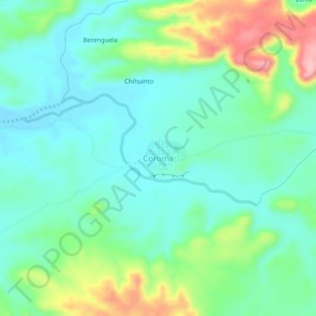
Name: Coroma topographic map, elevation, terrain.
Location: Coroma, Uyuni, Antonio Quijarro, Potosí, Bolivia (-19.54950 -66.83404 -19.50950 -66.79404)
Average elevation: 12,605 ft
Minimum elevation: 12,457 ft
Maximum elevation: 12,979 ft
Other topographic maps
Click on a map to view its topography, its elevation and its terrain.
Cerdas
Bolivia > Potosí > Antonio Quijarro > Uyuni
Cerdas, Uyuni, Antonio Quijarro, Potosí, Bolivia
Average elevation: 12,713 ft
Bella Vista
Bolivia > Potosí > Antonio Quijarro > Uyuni
Bella Vista, Uyuni, Antonio Quijarro, Potosí, Bolivia
Average elevation: 12,470 ft