
Thank you for supporting this site ❤️
Make a donation
Make a donation
Gear up for your next adventure:
As an Amazon Associate, this site earns from qualifying purchases at no extra cost to you.
Vicopelago topographic map
Click on the map to display elevation.
Thank you for supporting this site ❤️
Make a donation
Make a donation
Gear up for your next adventure:
As an Amazon Associate, this site earns from qualifying purchases at no extra cost to you.
About this map
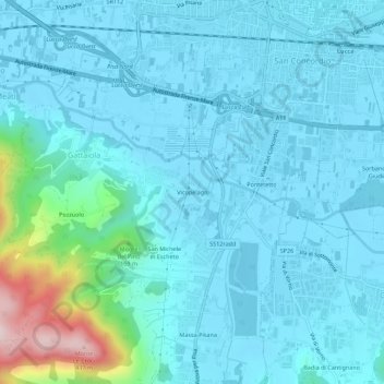
Name: Vicopelago topographic map, elevation, terrain.
Location: Vicopelago, Gattaiola, Lucca, Tuscany, 55057, Italy (43.80183 10.46407 43.84183 10.50407)
Average elevation: 200 ft
Minimum elevation: 30 ft
Maximum elevation: 1,411 ft
Thank you for supporting this site ❤️
Make a donation
Make a donation
Gear up for your next adventure:
As an Amazon Associate, this site earns from qualifying purchases at no extra cost to you.