Geolocate

Mount Talinis topographic map

Click on the map to display elevation.

About this map
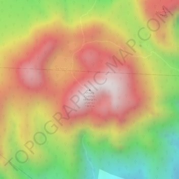
Name: Mount Talinis topographic map, elevation, terrain.

Location: Mount Talinis, Dauin, Negros Oriental, Negros Island Region, Philippines (9.24446 123.17776 9.24456 123.17786)

Average elevation: 4,843 ft

Minimum elevation: 3,274 ft

Maximum elevation: 5,981 ft

Other topographic maps

Click on a map to view its topography, its elevation and its terrain.

Bulak

Philippines > Negros Oriental > Dauin

Average elevation: 85 ft

Apo Island

Philippines > Negros Oriental > Dauin > Apo Island

Average elevation: 10 ft

Maayongtubig

Philippines > Negros Oriental > Dauin

Average elevation: 148 ft

Gear up for your next adventure:

🎒Waterproof Dry Bags - Keep your electronics and maps dry inside your pack
🌲Outdoor Survival Books - Best books on survival skills
🗃️Trail First Aid Kit - Essential kit for outdoor injuries and emergencies
🔥Plasma Lighters - Windproof lighters that work in any weather condition
🕶️GPS Smartphone Mount - Secure mount for phone navigation

As an Amazon Associate, this site earns from qualifying purchases at no extra cost to you.