Geolocate

Javier topographic map

Click on the map to display elevation.

About this map

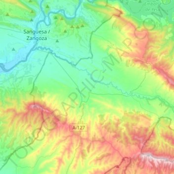
Name: Javier topographic map, elevation, terrain.

Location: Javier, Zangozerria, Navarre, 31411, Spain (42.42394 -1.34616 42.61304 -1.17548)

Average elevation: 2,044 ft

Minimum elevation: 1,263 ft

Maximum elevation: 3,766 ft

Gear up for your next adventure:

🕶️Glacier Sunglasses - Side shields to protect eyes from high-altitude snow glare
🥾Hiking Shoes - Durable and comfortable shoes for trail hiking
🪶Trail Camera - Capture wildlife on your hikes
🕶️GPS Smartphone Mount - Secure mount for phone navigation
🛠️Outdoor Gear Repair Kit - Essential tools to fix gear on the trail

As an Amazon Associate, this site earns from qualifying purchases at no extra cost to you.