
Lambton topographic map
Interactive map
Click on the map to display elevation.
About this map
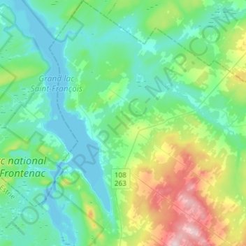
Name: Lambton topographic map, elevation, terrain.
Location: Lambton, Le Granit, Estrie, Quebec, G0M 1H0, Canada (45.78779 -71.16329 45.95738 -70.99016)
Average elevation: 1,142 ft
Minimum elevation: 928 ft
Maximum elevation: 1,877 ft