
Thank you for supporting this site ❤️
Make a donation
Make a donation
Gear up for your next adventure:
As an Amazon Associate, this site earns from qualifying purchases at no extra cost to you.
Talltorta topographic map
Click on the map to display elevation.
Thank you for supporting this site ❤️
Make a donation
Make a donation
Gear up for your next adventure:
As an Amazon Associate, this site earns from qualifying purchases at no extra cost to you.
About this map
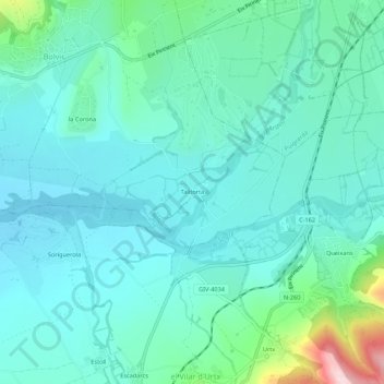
Name: Talltorta topographic map, elevation, terrain.
Location: Talltorta, Bolvir, Cerdaña, Gerona, Cataluña, 17539, España (42.38377 1.87938 42.42377 1.91938)
Average elevation: 3,691 ft
Minimum elevation: 3,501 ft
Maximum elevation: 4,547 ft
Thank you for supporting this site ❤️
Make a donation
Make a donation
Gear up for your next adventure:
As an Amazon Associate, this site earns from qualifying purchases at no extra cost to you.