Geolocate

Lodore topographic map

Click on the map to display elevation.

About this map

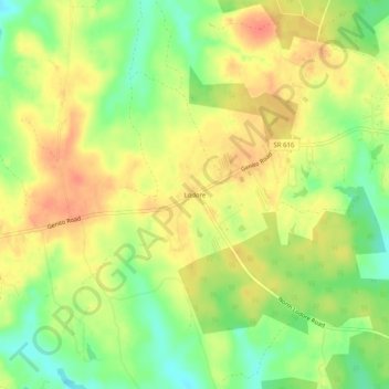
Name: Lodore topographic map, elevation, terrain.

Location: Lodore, Amelia County, Virginia, United States (37.41932 -78.04250 37.45932 -78.00250)

Average elevation: 335 ft

Minimum elevation: 246 ft

Maximum elevation: 404 ft

Amelia County trails, hiking, mountain biking, running and outdoor activities

Gear up for your next adventure:

🪄Magnetic Compass - Accurate compass for navigation
🦟Ultrasonic Repellers - Create a bug-free zone at your camp or rest stop
🧭Outdoor Navigation Book - Learn advanced navigation skills
🔋Rechargeable Batteries - Power up your outdoor devices
🧣Merino Neck Gaiters - Multi-functional headwear for wind and sun protection

As an Amazon Associate, this site earns from qualifying purchases at no extra cost to you.