Geolocate

Sector 14 topographic map

Click on the map to display elevation.

About this map

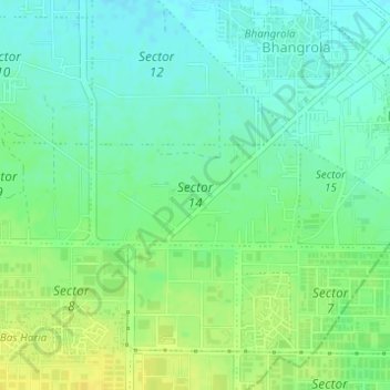
Name: Sector 14 topographic map, elevation, terrain.

Location: Sector 14, Manesar, Gurgaon, Gurugram, Haryana, India (28.37972 76.89327 28.38683 76.90989)

Average elevation: 771 ft

Minimum elevation: 741 ft

Maximum elevation: 807 ft

Other topographic maps

Click on a map to view its topography, its elevation and its terrain.

Sohna

India > Haryana > Gurugram

Average elevation: 751 ft

Ghamroj

India > Haryana > Gurugram

Average elevation: 804 ft

Gear up for your next adventure:

🌲Outdoor Survival Books - Best books on survival skills
🩳Quick‑Dry Hiking Shorts - Comfortable and quick‑dry shorts for summer hiking
🧣Hiking Neck Gaiter - Multi‑use neck protection for outdoor weather
👟Trail Running Shoes - Lightweight shoes for trail runners
👖Convertible Hiking Pants - Versatile zip-off pants for changing altitudes and temperatures

As an Amazon Associate, this site earns from qualifying purchases at no extra cost to you.