
Spearhead Glacier topographic map
Interactive map
Click on the map to display elevation.
About this map
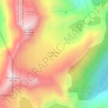
Name: Spearhead Glacier topographic map, elevation, terrain.
Average elevation: 6,831 ft
Minimum elevation: 5,394 ft
Maximum elevation: 7,986 ft
Other topographic maps
Click on a map to view its topography, its elevation and its terrain.
Blackcomb Glacier
Canada > British Columbia > Whistler Resort Municipality
Blackcomb Glacier, Green Line, Whistler Resort Municipality, Squamish-Lillooet Regional District, British Columbia, Canada
Average elevation: 6,969 ft