
Croix Scaille topographic map
Click on the map to display elevation.
Croix Scaille
Point culminant du versant méridional du Massif ardennais, avec 504 mètres d'altitude, il se trouve exactement à la frontière franco-belge, à la limite du département des Ardennes (commune des Hautes-Rivières), et de la province de Namur (commune de Gedinne).
About this map
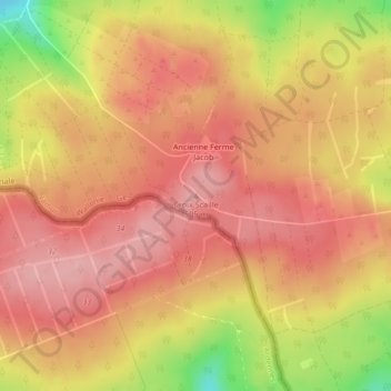
Name: Croix Scaille topographic map, elevation, terrain.
Location: Croix Scaille, Gedinne, Dinant, Namur, Wallonie, Belgique (49.95118 4.84485 49.95128 4.84495)
Average elevation: 1,522 ft
Minimum elevation: 1,211 ft
Maximum elevation: 1,667 ft