
Make a donation
Gear up for your next adventure:
As an Amazon Associate, this site earns from qualifying purchases at no extra cost to you.
Montevideo topographic map
Click on the map to display elevation.
Make a donation
Gear up for your next adventure:
As an Amazon Associate, this site earns from qualifying purchases at no extra cost to you.
Montevideo
The surrounding topography is dominated by farmland and prairies, as well as river valleys with many scenic overlooks and small bluffs.
Make a donation
Gear up for your next adventure:
As an Amazon Associate, this site earns from qualifying purchases at no extra cost to you.
About this map
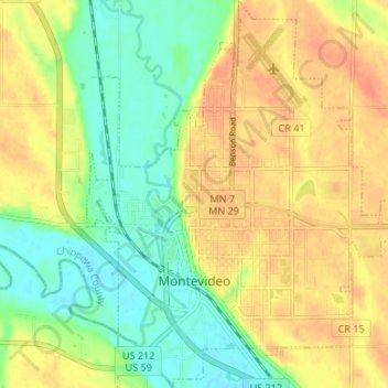
Name: Montevideo topographic map, elevation, terrain.
Location: Montevideo, Chippewa County, Minnesota, United States (44.92942 -95.74208 44.97665 -95.67996)
Average elevation: 991 ft
Minimum elevation: 919 ft
Maximum elevation: 1,060 ft
Make a donation
Gear up for your next adventure:
As an Amazon Associate, this site earns from qualifying purchases at no extra cost to you.