
Thank you for supporting this site ❤️
Make a donation
Make a donation
Gear up for your next adventure:
As an Amazon Associate, this site earns from qualifying purchases at no extra cost to you.
Quincemil topographic map
Click on the map to display elevation.
Thank you for supporting this site ❤️
Make a donation
Make a donation
Gear up for your next adventure:
As an Amazon Associate, this site earns from qualifying purchases at no extra cost to you.
About this map
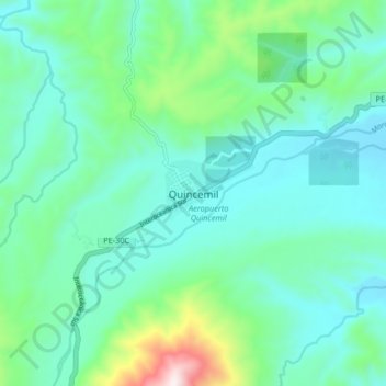
Name: Quincemil topographic map, elevation, terrain.
Location: Quincemil, Camanti, Province of Quispicanchis, Cusco, Peru (-13.27075 -70.79434 -13.19075 -70.71434)
Average elevation: 2,438 ft
Minimum elevation: 1,906 ft
Maximum elevation: 4,573 ft
Thank you for supporting this site ❤️
Make a donation
Make a donation
Gear up for your next adventure:
As an Amazon Associate, this site earns from qualifying purchases at no extra cost to you.