Geolocate

Bellini topographic map

Click on the map to display elevation.

About this map

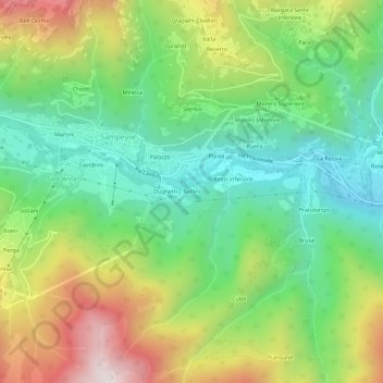
Name: Bellini topographic map, elevation, terrain.

Location: Bellini, Sampeyre, Cuneo, Piemonte, Italia (44.55395 7.17969 44.59395 7.21969)

Average elevation: 4,029 ft

Minimum elevation: 2,743 ft

Maximum elevation: 6,158 ft

Other topographic maps

Click on a map to view its topography, its elevation and its terrain.

Lago di Luca

Italia > Piemonte > Cuneo > Sampeyre

Average elevation: 7,684 ft

Gear up for your next adventure:

🏕️Tent Footprint - Protect your tent base from wear
🕶️GPS Smartphone Mount - Secure mount for phone navigation
🔥Camping Stove - Portable stove for camping and backcountry cooking
Solar GPS Watches - Advanced multisport watches with built-in topographic maps
📡Handheld GPS Device - Reliable handheld GPS for outdoor navigation

As an Amazon Associate, this site earns from qualifying purchases at no extra cost to you.