
Thank you for supporting this site ❤️
Make a donation
Make a donation
Gear up for your next adventure:
As an Amazon Associate, this site earns from qualifying purchases at no extra cost to you.
Cherubei topographic map
Click on the map to display elevation.
Thank you for supporting this site ❤️
Make a donation
Make a donation
Gear up for your next adventure:
As an Amazon Associate, this site earns from qualifying purchases at no extra cost to you.
About this map
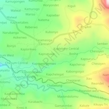
Name: Cherubei topographic map, elevation, terrain.
Location: Cherubei, Kapchorwa, Eastern Region, Uganda (1.29545 34.32375 1.33545 34.36375)
Average elevation: 4,793 ft
Minimum elevation: 4,085 ft
Maximum elevation: 5,935 ft
Thank you for supporting this site ❤️
Make a donation
Make a donation
Gear up for your next adventure:
As an Amazon Associate, this site earns from qualifying purchases at no extra cost to you.