Geolocate

Linawan topographic map

Click on the map to display elevation.

About this map

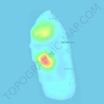
Name: Linawan topographic map, elevation, terrain.

Location: Linawan, Tabuan-Lasa, Basilan, Bangsamoro, 7312, Philippines (6.31662 121.92495 6.31672 121.92505)

Average elevation: 13 ft

Minimum elevation: 0 ft

Maximum elevation: 299 ft

Gear up for your next adventure:

🎒Trail Energy Bars - High‑calorie bars for hiking energy
🧭Pro Hiking Compasses - High-accuracy liquid-filled compasses for topographic orientation
🪶Wildlife Field Guides - Learn animal tracking and species ID
📱Heavy-Duty Phone Cases - Drop-proof and waterproof protection for outdoor navigation
🔦Powerful Headlamps - Ultra-bright hands-free lighting for night navigation

As an Amazon Associate, this site earns from qualifying purchases at no extra cost to you.