Geolocate

Hanna topographic map

Click on the map to display elevation.

About this map

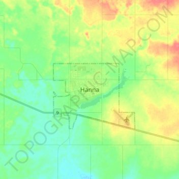
Name: Hanna topographic map, elevation, terrain.

Location: Hanna, Alberta, T0J 1P0, Canada (51.60456 -111.96748 51.68456 -111.88748)

Average elevation: 2,687 ft

Minimum elevation: 2,621 ft

Maximum elevation: 2,792 ft

Gear up for your next adventure:

📦Dry Bags Set - Waterproof storage for electronics and clothes
🏕️Family Camping Gear - Essentials for group camping trips
🎒Outdoor Daypacks - Lightweight backpacks designed for carrying maps and essential gear
📡GPS Antenna Upgrade - Enhance GPS reception in remote terrain
🗃️Trail First Aid Kit - Essential kit for outdoor injuries and emergencies

As an Amazon Associate, this site earns from qualifying purchases at no extra cost to you.