

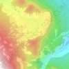
MAGAM topographic map
Click on the map to display elevation.
About this map

Name: MAGAM topographic map, elevation, terrain.
Location: MAGAM, Tangmarg, Baramulla, Jammu and Kashmir, India (34.08793 74.58051 34.09630 74.60028)
Average elevation: 5,223 ft
Minimum elevation: 5,197 ft
Maximum elevation: 5,335 ft
Other topographic maps
Click on a map to view its topography, its elevation and its terrain.

Gulmarg
India > Jammu and Kashmir > Tangmarg
Gulmarg (also known as Gulmarag, lit. 'meadow of flowers' in Kashmiri) is a hill station and a notified area committee in Baramulla district of the Indian union territory of Jammu and Kashmir. It is located in the Indian administered Kashmir, close to the Line of Control that serves as the de facto border…
Average elevation: 8,497 ft


Gulmarg
India > Jammu and Kashmir > Tangmarg
Gulmarg (also known as Gulmarag, lit. 'meadow of flowers' in Kashmiri) is a hill station and a notified area committee in Baramulla district of the Indian union territory of Jammu and Kashmir. It is located in the Indian-administered part of Kashmir, close to the Line of Control that serves as the de facto…
Average elevation: 8,497 ft
Gulmarg
India > Jammu and Kashmir > Tangmarg
Gulmarg (also known as Gulmarag, lit. 'meadow of flowers' in Kashmiri) is a hill station and a notified area committee in Baramulla district of the Indian union territory of Jammu and Kashmir. It is located in the Indian-administered part of Kashmir, close to the Line of Control that serves as the de facto…
Average elevation: 8,497 ft
Gulmarg
India > Jammu and Kashmir > Tangmarg
Gulmarg (also known as Gulmarag, lit. 'meadow of flowers' in Kashmiri) is a hill station and a notified area committee in Baramulla district of the Indian union territory of Jammu and Kashmir. It is located in the Indian administered Kashmir, close to the Line of Control that serves as the de facto border…
Average elevation: 8,497 ft
Gulmarg
India > Jammu and Kashmir > Tangmarg
Gulmarg (also known as Gulmarag, lit. 'meadow of flowers' in Kashmiri) is a hill station and a notified area committee in Baramulla district of the Indian union territory of Jammu and Kashmir. It is located in the Indian administered Kashmir, close to the Line of Control that serves as the de facto border…
Average elevation: 8,497 ft
Gulmarg
India > Jammu and Kashmir > Tangmarg
Yousuf Shah Chak, who ruled Kashmir from 1579 to 1586, frequented the place with his queen Habba Khatoon and renamed it 'Gulmarg' ("meadow of flowers"). Wild flowers of 21 different varieties were collected by the Mughal emperor Jahangir for his gardens in Gulmarg. In the 19th century, British civil servants…
Average elevation: 8,497 ft