
Thank you for supporting this site ❤️
Make a donation
Make a donation
Gear up for your next adventure:
As an Amazon Associate, this site earns from qualifying purchases at no extra cost to you.
Haversin topographic map
Click on the map to display elevation.
Thank you for supporting this site ❤️
Make a donation
Make a donation
Gear up for your next adventure:
As an Amazon Associate, this site earns from qualifying purchases at no extra cost to you.
About this map
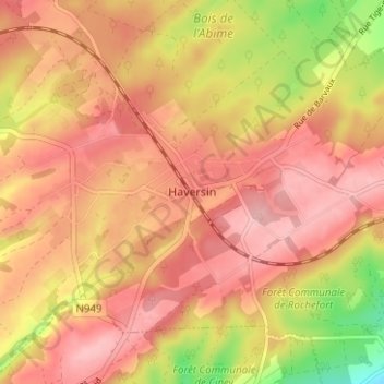
Name: Haversin topographic map, elevation, terrain.
Location: Haversin, Ciney, Dinant, Namen, Wallonië, HAVERSIN, België (50.22891 5.17495 50.26891 5.21495)
Average elevation: 968 ft
Minimum elevation: 669 ft
Maximum elevation: 1,119 ft
Thank you for supporting this site ❤️
Make a donation
Make a donation
Gear up for your next adventure:
As an Amazon Associate, this site earns from qualifying purchases at no extra cost to you.