Geolocate

MANDWAAL topographic map

Click on the map to display elevation.

About this map

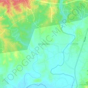
Name: MANDWAAL topographic map, elevation, terrain.

Location: MANDWAAL, Rawalpindi Saddar Tehsil, Rawalpindi District, Rawalpindi Division, Punjab, Pakistan (33.40116 72.83773 33.44116 72.87773)

Average elevation: 1,332 ft

Minimum elevation: 1,257 ft

Maximum elevation: 1,509 ft

Other topographic maps

Click on a map to view its topography, its elevation and its terrain.

Rawalpindi Cantonment

Pakistan > Punjab > Rawalpindi District

Average elevation: 1,608 ft

Chakri

Pakistan > Punjab > Rawalpindi District

Average elevation: 1,161 ft

Gujar Khan Tehsil

Pakistan > Punjab > Rawalpindi District

Average elevation: 1,568 ft

Park

Pakistan > Punjab > Rawalpindi District

Average elevation: 1,572 ft

Kallar Syedan Tehsil

Pakistan > Punjab > Rawalpindi District

Average elevation: 1,768 ft

Gear up for your next adventure:

🧣Merino Neck Gaiters - Multi-functional headwear for wind and sun protection
🧤Hiking Gloves - Protective gloves for rugged trails
📷Action Camera - Capture your outdoor adventures in HD
🧯Emergency Survival Kit - All‑in‑one survival essentials for the backcountry
🕶️Glacier Sunglasses - Side shields to protect eyes from high-altitude snow glare

As an Amazon Associate, this site earns from qualifying purchases at no extra cost to you.