
Thank you for supporting this site ❤️
Make a donation
Make a donation
Gear up for your next adventure:
As an Amazon Associate, this site earns from qualifying purchases at no extra cost to you.
Brite topographic map
Click on the map to display elevation.
Thank you for supporting this site ❤️
Make a donation
Make a donation
Gear up for your next adventure:
As an Amazon Associate, this site earns from qualifying purchases at no extra cost to you.
About this map
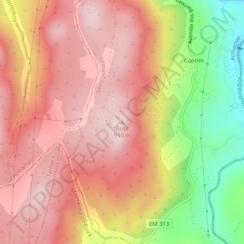
Name: Brite topographic map, elevation, terrain.
Location: Brite, Armamar, Viseu, North, 3620-909, Portugal (41.03426 -7.65067 41.03436 -7.65057)
Average elevation: 2,566 ft
Minimum elevation: 1,775 ft
Maximum elevation: 3,025 ft
Thank you for supporting this site ❤️
Make a donation
Make a donation
Gear up for your next adventure:
As an Amazon Associate, this site earns from qualifying purchases at no extra cost to you.