
Thank you for supporting this site ❤️
Make a donation
Make a donation
Gear up for your next adventure:
As an Amazon Associate, this site earns from qualifying purchases at no extra cost to you.
Otongo topographic map
Click on the map to display elevation.
Thank you for supporting this site ❤️
Make a donation
Make a donation
Gear up for your next adventure:
As an Amazon Associate, this site earns from qualifying purchases at no extra cost to you.
About this map
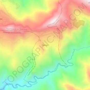
Name: Otongo topographic map, elevation, terrain.
Location: Otongo, Tepehuacán de Guerrero, Hidalgo, México (20.94225 -98.77825 20.98225 -98.73825)
Average elevation: 3,012 ft
Minimum elevation: 1,558 ft
Maximum elevation: 4,501 ft
Thank you for supporting this site ❤️
Make a donation
Make a donation
Gear up for your next adventure:
As an Amazon Associate, this site earns from qualifying purchases at no extra cost to you.