Geolocate

Edapally topographic map

Click on the map to display elevation.

About this map

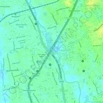
Name: Edapally topographic map, elevation, terrain.

Location: Edapally, Kanayannur, Ernakulam district, Kerala, India (10.01887 76.30304 10.03057 76.31402)

Average elevation: 30 ft

Minimum elevation: 3 ft

Maximum elevation: 59 ft

Gear up for your next adventure:

🔦LED Headlamp - Bright and durable LED headlamp for night navigation
🎒Gear Packing Cubes - Organize your backpack efficiently
🧭Map Reading Tools - Tools and kits for map navigation
🌡️Portable Weather Meter - Track weather conditions on the trail
🚁Photography Drones - Capture stunning aerial views of landforms and topography

As an Amazon Associate, this site earns from qualifying purchases at no extra cost to you.