Geolocate

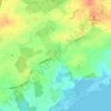
Loose topographic map

Click on the map to display elevation.

About this map

Name: Loose topographic map, elevation, terrain.

Location: Loose, Schlei-Ostsee, Kreis Rendsburg-Eckernförde, Schleswig-Holstein, 24366, Germany (54.50585 9.83528 54.54157 9.93715)

Average elevation: 82 ft

Minimum elevation: -10 ft

Maximum elevation: 151 ft

Other topographic maps

Click on a map to view its topography, its elevation and its terrain.

Gear up for your next adventure:

🌡️Handheld Weather Meters - Measure wind, temp, and pressure for safe mountain travel
🏥Hiking First Aid Kits - Comprehensive medical kits for remote trail injuries
🛡️Bear Spray Outdoor - Protection in bear country hikes
🔭Compact Binoculars - HD vision for scouting terrain and identifying distant landmarks
🚗GPS Dash Cams - Record your scenic drives through mountain passes and canyons

As an Amazon Associate, this site earns from qualifying purchases at no extra cost to you.