
Thank you for supporting this site ❤️
Make a donation
Make a donation
Gear up for your next adventure:
As an Amazon Associate, this site earns from qualifying purchases at no extra cost to you.
Conflent topographic map
Click on the map to display elevation.
Thank you for supporting this site ❤️
Make a donation
Make a donation
Gear up for your next adventure:
As an Amazon Associate, this site earns from qualifying purchases at no extra cost to you.
About this map
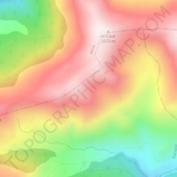
Name: Conflent topographic map, elevation, terrain.
Location: Conflent, Farrera, Pallars Sobirà, Lleida, Catalonia, Spain (42.49993 1.34235 42.51993 1.36235)
Average elevation: 7,264 ft
Minimum elevation: 5,735 ft
Maximum elevation: 8,445 ft
Thank you for supporting this site ❤️
Make a donation
Make a donation
Gear up for your next adventure:
As an Amazon Associate, this site earns from qualifying purchases at no extra cost to you.