Geolocate

Burwell topographic map

Click on the map to display elevation.

About this map

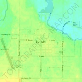
Name: Burwell topographic map, elevation, terrain.

Location: Burwell, Garfield County, Nebraska, United States (41.77289 -99.14855 41.79075 -99.12038)

Average elevation: 2,172 ft

Minimum elevation: 2,129 ft

Maximum elevation: 2,205 ft

Garfield County trails, hiking, mountain biking, running and outdoor activities

Gear up for your next adventure:

Camping Coffee Makers - Enjoy premium coffee at the summit or campsite
🚗GPS Dash Cams - Record your scenic drives through mountain passes and canyons
🪓Survival Multi‑Tool - Versatile tool for camp and trail tasks
🔦Compact Flashlight - Reliable flashlight for emergencies
🧣Merino Neck Gaiters - Multi-functional headwear for wind and sun protection

As an Amazon Associate, this site earns from qualifying purchases at no extra cost to you.