
Thank you for supporting this site ❤️
Make a donation
Make a donation
Gear up for your next adventure:
As an Amazon Associate, this site earns from qualifying purchases at no extra cost to you.
Irschenberg topographic map
Click on the map to display elevation.
Thank you for supporting this site ❤️
Make a donation
Make a donation
Gear up for your next adventure:
As an Amazon Associate, this site earns from qualifying purchases at no extra cost to you.
About this map
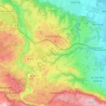
Name: Irschenberg topographic map, elevation, terrain.
Location: Irschenberg, Landkreis Miesbach, Baviera, 83737, Alemanha (47.77353 11.83076 47.86489 11.95884)
Average elevation: 2,106 ft
Minimum elevation: 1,565 ft
Maximum elevation: 2,897 ft
Thank you for supporting this site ❤️
Make a donation
Make a donation
Gear up for your next adventure:
As an Amazon Associate, this site earns from qualifying purchases at no extra cost to you.