Geolocate

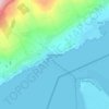
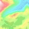
Carrowkeel topographic map

Click on the map to display elevation.

About this map

Name: Carrowkeel topographic map, elevation, terrain.

Location: Carrowkeel, County Donegal, Ulster, F92 PP6R, Ireland (55.12816 -7.67830 55.14477 -7.65104)

Average elevation: 164 ft

Minimum elevation: 0 ft

Maximum elevation: 889 ft

Other topographic maps

Click on a map to view its topography, its elevation and its terrain.
Donegal

Ireland > County Donegal > Donegal

Average elevation: 157 ft

Newtown Cunningham

Ireland > County Donegal

Average elevation: 82 ft

Greencastle

Ireland > County Donegal

Average elevation: 151 ft

Portsalon

Ireland > County Donegal > Letterkenny

Average elevation: 89 ft

Mamore Gap

Ireland > County Donegal

Average elevation: 630 ft

Fintown

Ireland > County Donegal

Average elevation: 614 ft

Cashel

Ireland > County Donegal

Average elevation: 354 ft

Carndonagh

Ireland > County Donegal > Carndonagh

Average elevation: 256 ft

Maum

Ireland > County Donegal

Average elevation: 587 ft

Gear up for your next adventure:

🪓Survival Multi‑Tool - Versatile tool for camp and trail tasks
🦺Reflective Outdoor Gear - Safety gear for low‑light conditions
🔥Fast-Boil Camping Stoves - Efficient cooking systems for quick trail meals
📡Handheld GPS Device - Reliable handheld GPS for outdoor navigation
📶Vehicle Signal Boosters - Improve reception in rural areas while driving to trailheads

As an Amazon Associate, this site earns from qualifying purchases at no extra cost to you.