
Thank you for supporting this site ❤️
Make a donation
Make a donation
Gear up for your next adventure:
As an Amazon Associate, this site earns from qualifying purchases at no extra cost to you.
Penedos topographic map
Click on the map to display elevation.
Thank you for supporting this site ❤️
Make a donation
Make a donation
Gear up for your next adventure:
As an Amazon Associate, this site earns from qualifying purchases at no extra cost to you.
About this map
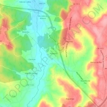
Name: Penedos topographic map, elevation, terrain.
Location: Penedos, Almagreira, Pombal, Leiria, 3105-005, Portugal (39.94342 -8.71750 39.98342 -8.67750)
Average elevation: 240 ft
Minimum elevation: 56 ft
Maximum elevation: 436 ft
Thank you for supporting this site ❤️
Make a donation
Make a donation
Gear up for your next adventure:
As an Amazon Associate, this site earns from qualifying purchases at no extra cost to you.