Geolocate

Chonta topographic map

Click on the map to display elevation.

About this map

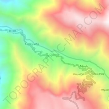
Name: Chonta topographic map, elevation, terrain.

Location: Chonta, Querobamba, Sucre, Ayacucho, Peru (-13.99380 -73.88073 -13.95380 -73.84073)

Average elevation: 9,882 ft

Minimum elevation: 7,536 ft

Maximum elevation: 11,929 ft

Gear up for your next adventure:

📡Handheld GPS Device - Reliable handheld GPS for outdoor navigation
🧭Hiking Compass - Precision compass for reliable navigation in the wilderness
🌡️Portable Weather Meter - Track weather conditions on the trail
🔋Rechargeable Batteries - Power up your outdoor devices
🧭Pro Hiking Compasses - High-accuracy liquid-filled compasses for topographic orientation

As an Amazon Associate, this site earns from qualifying purchases at no extra cost to you.