
Make a donation
Gear up for your next adventure:
As an Amazon Associate, this site earns from qualifying purchases at no extra cost to you.
Vieu topographic map
Click on the map to display elevation.
Make a donation
Gear up for your next adventure:
As an Amazon Associate, this site earns from qualifying purchases at no extra cost to you.
About this map
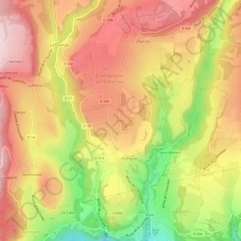
Name: Vieu topographic map, elevation, terrain.
Average elevation: 1,575 ft
Minimum elevation: 935 ft
Maximum elevation: 2,018 ft
Make a donation
Gear up for your next adventure:
As an Amazon Associate, this site earns from qualifying purchases at no extra cost to you.
Other topographic maps
Click on a map to view its topography, its elevation and its terrain.
Sutrieu
France > Auvergne-Rhône-Alpes > Ain > Valromey-sur-Séran
La superficie de la commune est de 1 905 hectares ; son altitude varie entre 459 et 1 200 mètres.
Average elevation: 2,287 ft
Belmont-Luthézieu
France > Auvergne-Rhône-Alpes > Ain > Valromey-sur-Séran
Average elevation: 2,195 ft
Fitignieu
France > Auvergne-Rhône-Alpes > Ain > Valromey-sur-Séran > Sutrieu
Average elevation: 1,854 ft
Charancin
France > Auvergne-Rhône-Alpes > Ain > Valromey-sur-Séran > Sutrieu
Average elevation: 2,464 ft
Make a donation
Gear up for your next adventure:
As an Amazon Associate, this site earns from qualifying purchases at no extra cost to you.