
Thank you for supporting this site ❤️
Make a donation
Make a donation
Gear up for your next adventure:
As an Amazon Associate, this site earns from qualifying purchases at no extra cost to you.
Hemis Shukpachan topographic map
Click on the map to display elevation.
Thank you for supporting this site ❤️
Make a donation
Make a donation
Gear up for your next adventure:
As an Amazon Associate, this site earns from qualifying purchases at no extra cost to you.
About this map
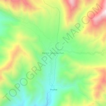
Name: Hemis Shukpachan topographic map, elevation, terrain.
Location: Hemis Shukpachan, Khalsi tehsil, Leh District, Ladakh, India (34.29591 77.05741 34.33591 77.09741)
Average elevation: 12,526 ft
Minimum elevation: 11,276 ft
Maximum elevation: 14,308 ft
Thank you for supporting this site ❤️
Make a donation
Make a donation
Gear up for your next adventure:
As an Amazon Associate, this site earns from qualifying purchases at no extra cost to you.