Geolocate

Kwai topographic map

Click on the map to display elevation.

About this map

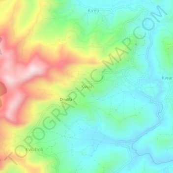
Name: Kwai topographic map, elevation, terrain.

Location: Kwai, Lushoto, Tanga Region, Northern Zone, Tanzania (-4.74630 38.32318 -4.70630 38.36318)

Average elevation: 5,728 ft

Minimum elevation: 5,095 ft

Maximum elevation: 6,959 ft

Other topographic maps

Click on a map to view its topography, its elevation and its terrain.

Handeni

Tanzania > Tanga Region

Average elevation: 1,253 ft

Korogwe

Tanzania > Tanga Region

Average elevation: 2,451 ft

Gear up for your next adventure:

🧼Biodegradable Camping Soap - Eco‑friendly soap for outdoor hygiene
🔭Stargazing Telescopes - Perfect for camping in low-light pollution areas shown on maps
GPS Sports Watch - GPS watch for running, hiking and training
🔦Compact Flashlight - Reliable flashlight for emergencies
🧴Hand Sanitizer - Keep hands clean while hiking

As an Amazon Associate, this site earns from qualifying purchases at no extra cost to you.