Geolocate

Trimble topographic map

Click on the map to display elevation.

About this map

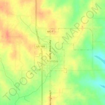
Name: Trimble topographic map, elevation, terrain.

Location: Trimble, Clinton County, Missouri, 64492, United States (39.46887 -94.57010 39.48136 -94.55062)

Average elevation: 951 ft

Minimum elevation: 860 ft

Maximum elevation: 1,014 ft

Clinton County trails, hiking, mountain biking, running and outdoor activities

Gear up for your next adventure:

🔋Rechargeable Batteries - Power up your outdoor devices
💧Water Filtration Bottles - Safely drink from streams and lakes while exploring
🌡️Portable Weather Meter - Track weather conditions on the trail
🪑Ultralight Camp Chairs - Portable seating for resting after a long day of mapping
🔭Stargazing Telescopes - Perfect for camping in low-light pollution areas shown on maps

As an Amazon Associate, this site earns from qualifying purchases at no extra cost to you.