
Thank you for supporting this site ❤️
Make a donation
Make a donation
Gear up for your next adventure:
As an Amazon Associate, this site earns from qualifying purchases at no extra cost to you.
Valle topographic map
Click on the map to display elevation.
Thank you for supporting this site ❤️
Make a donation
Make a donation
Gear up for your next adventure:
As an Amazon Associate, this site earns from qualifying purchases at no extra cost to you.
About this map
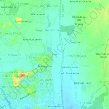
Name: Valle topographic map, elevation, terrain.
Location: Valle, La Angostura, San Juan Bautista, Ica, 11000, Peru (-14.04898 -75.75177 -14.00898 -75.71177)
Average elevation: 1,391 ft
Minimum elevation: 1,342 ft
Maximum elevation: 1,526 ft
Thank you for supporting this site ❤️
Make a donation
Make a donation
Gear up for your next adventure:
As an Amazon Associate, this site earns from qualifying purchases at no extra cost to you.