
Boorsem topographic map
Click on the map to display elevation.
Boorsem
Boorsem ligt in de vallei van de Maas, op een hoogte van 40-45 meter, en ten noorden van het dorp bevindt zich een grindgroeve. Sinds begin 19e eeuw werd het gebied van Boorsem doorsneden door de Zuid-Willemsvaart.
About this map
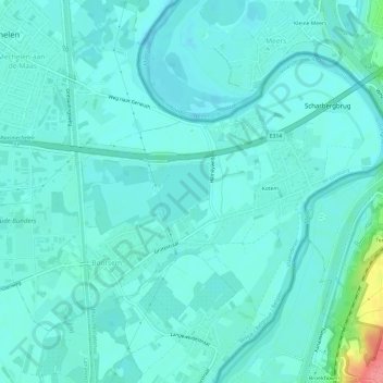
Name: Boorsem topographic map, elevation, terrain.
Location: Boorsem, Maasmechelen, Tongeren, Limburg, Vlaanderen, België (50.93408 5.69896 50.96164 5.75919)
Average elevation: 131 ft
Minimum elevation: 98 ft
Maximum elevation: 154 ft
Other topographic maps
Click on a map to view its topography, its elevation and its terrain.
Daalgrimbie
België > Limburg > Tongeren > Maasmechelen > Opgrimbie > Daalgrimbie
Average elevation: 144 ft