Geolocate

Cagayan topographic map

Click on the map to display elevation.

About this map

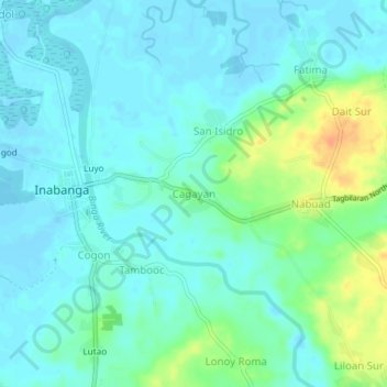
Name: Cagayan topographic map, elevation, terrain.

Location: Cagayan, Inabanga, Bohol, Central Visayas, Philippines (10.01048 124.05954 10.05048 124.09954)

Average elevation: 30 ft

Minimum elevation: -16 ft

Maximum elevation: 121 ft

Gear up for your next adventure:

🗻Climbing Gear Basics - Essential gear for beginner climbers
🎒Trekking Poles - Sturdy poles for balance and stability on rough terrain
🥾Women's Hiking Boots - Top-rated trail boots with ankle support and superior grip
🦟Ultrasonic Repellers - Create a bug-free zone at your camp or rest stop
🎒Day Hiking Backpack - Lightweight backpack perfect for day trips and outdoor adventures

As an Amazon Associate, this site earns from qualifying purchases at no extra cost to you.