Geolocate

Oak Level topographic map

Click on the map to display elevation.

About this map

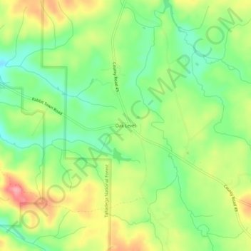
Name: Oak Level topographic map, elevation, terrain.

Location: Oak Level, Cleburne County, Alabama, United States (33.82955 -85.49801 33.86955 -85.45801)

Average elevation: 1,010 ft

Minimum elevation: 856 ft

Maximum elevation: 1,211 ft

Cleburne County trails, hiking, mountain biking, running and outdoor activities

Gear up for your next adventure:

📡GPS Antenna Upgrade - Enhance GPS reception in remote terrain
🩹Survival Bandages - High‑quality bandages for emergencies
🪶Camping Sleeping Pad - Comfortable sleeping pad for backpacking
🔥Plasma Lighters - Windproof lighters that work in any weather condition
🕶️GPS Smartphone Mount - Secure mount for phone navigation

As an Amazon Associate, this site earns from qualifying purchases at no extra cost to you.