
马关县 topographic map
Interactive map
Click on the map to display elevation.
About this map
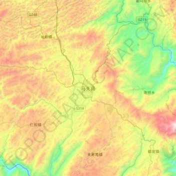
Name: 马关县 topographic map, elevation, terrain.
Location: 马关县, 白马镇, 马关县, 文山壮族苗族自治州, 云南省, 663700, 中国 (22.85564 104.23232 23.17564 104.55232)
Average elevation: 4,518 ft
Minimum elevation: 2,014 ft
Maximum elevation: 7,894 ft
Other topographic maps
Click on a map to view its topography, its elevation and its terrain.