
Thank you for supporting this site ❤️
Make a donation
Make a donation
Gear up for your next adventure:
As an Amazon Associate, this site earns from qualifying purchases at no extra cost to you.
Wallbach topographic map
Click on the map to display elevation.
Thank you for supporting this site ❤️
Make a donation
Make a donation
Gear up for your next adventure:
As an Amazon Associate, this site earns from qualifying purchases at no extra cost to you.
About this map
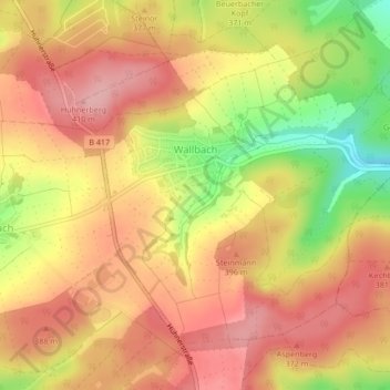
Name: Wallbach topographic map, elevation, terrain.
Location: Wallbach, Hünstetten, Rheingau-Taunus-Kreis, Hessen, Deutschland (50.23656 8.18467 50.25759 8.21996)
Average elevation: 1,211 ft
Minimum elevation: 932 ft
Maximum elevation: 1,371 ft
Thank you for supporting this site ❤️
Make a donation
Make a donation
Gear up for your next adventure:
As an Amazon Associate, this site earns from qualifying purchases at no extra cost to you.