
Thank you for supporting this site ❤️
Make a donation
Make a donation
Gear up for your next adventure:
As an Amazon Associate, this site earns from qualifying purchases at no extra cost to you.
Xonotla topographic map
Click on the map to display elevation.
Thank you for supporting this site ❤️
Make a donation
Make a donation
Gear up for your next adventure:
As an Amazon Associate, this site earns from qualifying purchases at no extra cost to you.
About this map
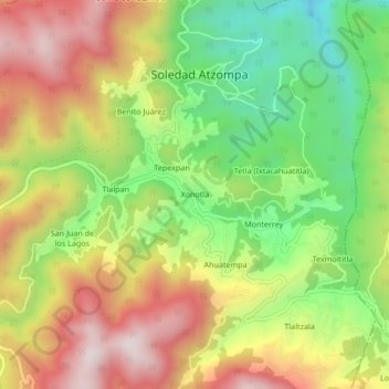
Name: Xonotla topographic map, elevation, terrain.
Location: Xonotla, Soledad Atzompa, Veracruz, México (18.72306 -97.17194 18.76306 -97.13194)
Average elevation: 7,336 ft
Minimum elevation: 6,178 ft
Maximum elevation: 8,566 ft
Thank you for supporting this site ❤️
Make a donation
Make a donation
Gear up for your next adventure:
As an Amazon Associate, this site earns from qualifying purchases at no extra cost to you.