Geolocate

Spert topographic map

Click on the map to display elevation.

About this map

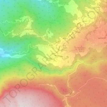
Name: Spert topographic map, elevation, terrain.

Location: Spert, Farra d'Alpago, Alpago, Belluno, Veneto, 32016, Italy (46.09376 12.38169 46.13376 12.42169)

Average elevation: 2,999 ft

Minimum elevation: 1,463 ft

Maximum elevation: 4,321 ft

Other topographic maps

Click on a map to view its topography, its elevation and its terrain.

Lago di Santa Croce

Italy > Veneto > Belluno > Farra d'Alpago

Average elevation: 1,778 ft

Gear up for your next adventure:

📡Handheld GPS Device - Reliable handheld GPS for outdoor navigation
🚁Photography Drones - Capture stunning aerial views of landforms and topography
🗺️Topographic Maps - Detailed topo maps for hiking, exploring and outdoor navigation
🚪Portable Camp Chair - Foldable chair for comfort at camp
🛶Inflatable Kayak - Portable kayak for rivers, lakes, and expeditions

As an Amazon Associate, this site earns from qualifying purchases at no extra cost to you.